
Santa Cruz County ZIP Coverage
These ZIP codes are associated with Santa Cruz County communities and delivery identities. The ZIP code directory is a navigation index. It should be checked against a complete address because USPS delivery routes do not form political polygons.
| ZIP | Areas associated with the county | Post office identity | Key note |
|---|---|---|---|
| 95001 | Aptos | Aptos PO boxes | PO-box ZIP |
| 95003 | Aptos, Rio del Mar, Seacliff, Aptos Hills | Aptos delivery area | Mostly unincorporated |
| 95005 | Ben Lomond and San Lorenzo Valley | Ben Lomond | Unincorporated |
| 95006 | Boulder Creek and upper San Lorenzo Valley | Boulder Creek | Rural mountain route |
| 95007 | Brookdale | Brookdale | Unincorporated postal identity |
| 95010 | Capitola and nearby edges | Capitola | Verify the city line in GIS |
| 95017 | Davenport and north-coast rural area | Davenport | Unincorporated coast |
| 95018 | Felton and nearby valley | Felton | Mount Hermon uses 95041 |
| 95019 | Freedom | Freedom | Adjoins Watsonville area |
| 95033 | Summit and Loma Prieta mountain area | Los Gatos | Crosses Santa Cruz and Santa Clara counties |
| 95041 | Mount Hermon | Mount Hermon | Distinct small postal identity |
| 95060 | Santa Cruz, UCSC vicinity, Bonny Doon, north coast | Santa Cruz | Extends beyond city limits |
| 95061 | Santa Cruz | Santa Cruz PO boxes | PO-box ZIP |
| 95062 | East Santa Cruz, Seabright, Live Oak, Pleasure Point | Santa Cruz and East Santa Cruz | City/county boundary mix |
| 95063 | Santa Cruz | Santa Cruz PO boxes | Special postal use |
| 95064 | University of California, Santa Cruz | UCSC campus | Unique institutional ZIP |
| 95065 | Upper east Santa Cruz, Pasatiempo, Santa Cruz Gardens | Santa Cruz | Incorporated and unincorporated mix |
| 95066 | Scotts Valley and nearby mountain areas | Scotts Valley | Postal area can exceed city limits |
| 95067 | Scotts Valley | Scotts Valley PO boxes | PO-box ZIP |
| 95073 | Soquel and nearby unincorporated areas | Soquel | Postal identities overlap nearby cities |
| 95076 | Watsonville, Corralitos, Amesti, Interlaken, La Selva Beach, Pajaro Valley | Watsonville | Broad city and rural coverage |
| 95077 | Watsonville | Watsonville PO boxes | PO-box ZIP |
The postal entries point to delivery areas. They do not establish a municipal address or list the people served by the route.
Postal ZIPs Are Not City Limits
A ZIP code is a delivery tool. Santa Cruz County has four incorporated cities, large unincorporated communities, and postal lines that cross those borders. “Santa Cruz, CA 95060” may describe City of Santa Cruz land or unincorporated Bonny Doon and north-coast territory. “Watsonville” can reach into Pajaro Valley communities and farmland. “Los Gatos” in 95033 can describe a parcel in northern Santa Cruz County.
Use a full-address USPS Address Lookup to check the mailing route, then use GIS to inspect the parcel and jurisdiction. The first result answers where mail is routed. The second tells you which city or county planning and permit office owns the address record.
The USPS address lookup capture belongs in a ZIP code directory because it shows why a place name alone is too broad.
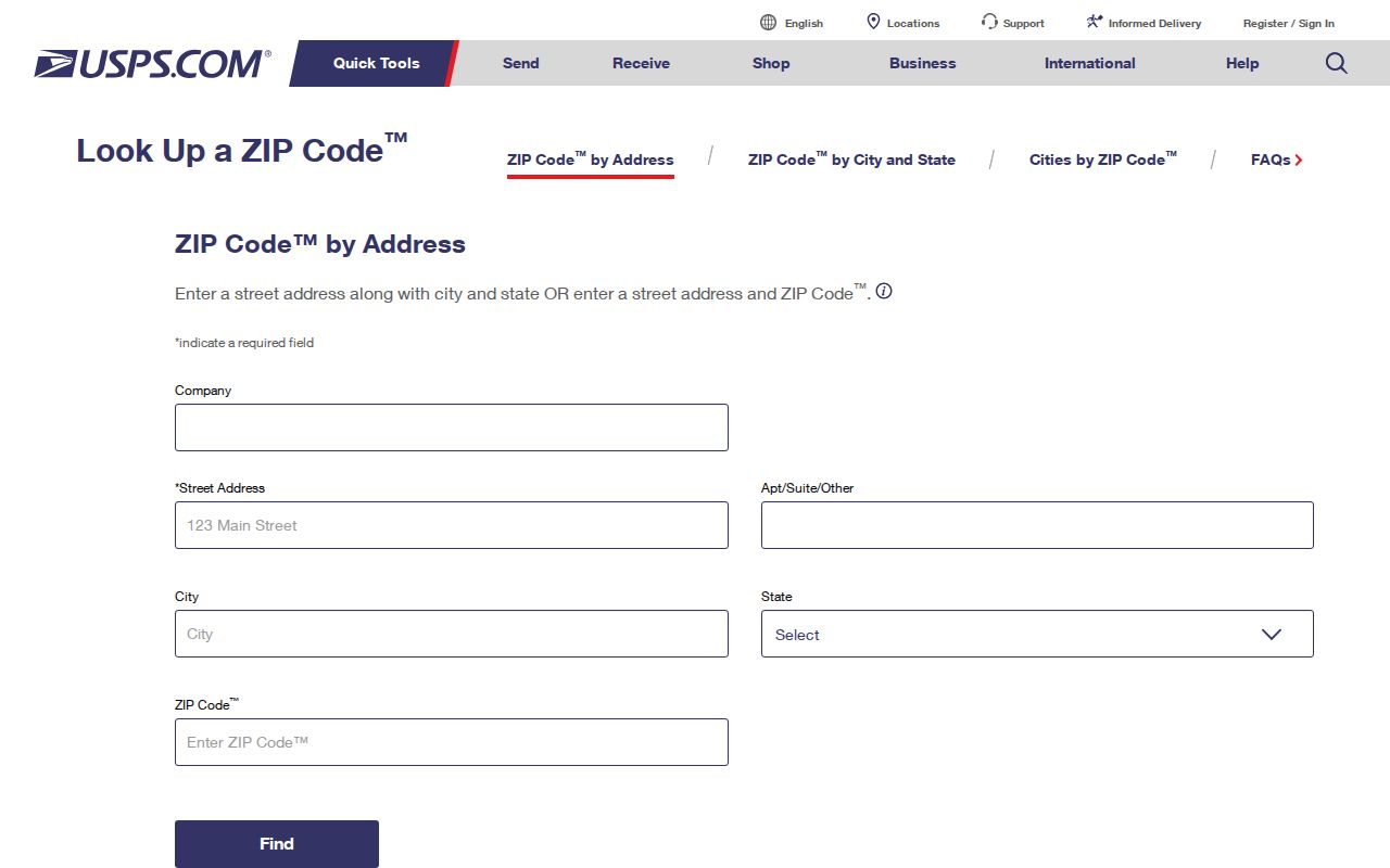
Keep four fields together: exact mailing line, situs address, APN, and governing jurisdiction. That four-part key prevents a ZIP label from sending a record request to the wrong office.
Santa Cruz Mountain ZIP Routes
San Lorenzo Valley postal codes describe a long mountain corridor rather than a neat town grid. Ben Lomond uses 95005, Boulder Creek 95006, Brookdale 95007, Felton 95018, and Mount Hermon 95041. A rural address can be far from the village named by the post office, and an unincorporated place does not become a city because it has its own delivery identity.
Rural route research benefits from APN and legal-description work. Use the address to locate the parcel in GIS. Copy the APN. Then select the county planning, assessor, recorder, or historical repository based on the parcel rather than on the postal name.
The USPS Location Finder capture supplies post-office context for a ZIP code directory, but it does not draw a municipal boundary.
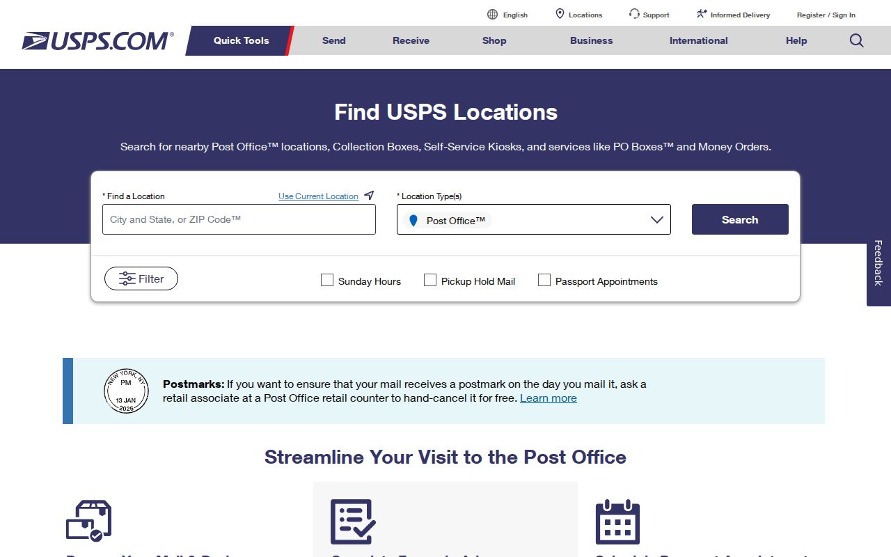
Street and address records should be kept at parcel level in mountain areas because community names and road labels can vary across older sources.
Aptos and Mid-County ZIP Mosaic
Aptos-area ZIP geography shows why the postal directory must include community names and notes. 95001 is an Aptos PO-box ZIP. 95003 reaches Aptos, Rio del Mar, Seacliff, Aptos Hills, and nearby unincorporated coast. 95010 is associated with Capitola and its edges. 95073 covers Soquel and nearby unincorporated land.
These labels do not replace a parcel test. A newspaper, directory, or family paper may use Aptos, Rio del Mar, Seacliff, Soquel, Capitola, or Santa Cruz for a nearby place. Repeat a historical name search with the period-appropriate community label, then compare the address and APN.
Postal, census, and neighborhood names can overlap while a permit, code file, or planning request follows the incorporated-city line. The mid-county mosaic is therefore a search aid and a warning.
Pajaro Valley ZIP Geography
ZIP 95076 is unusually broad. It associates with Watsonville, Corralitos, Amesti, Interlaken, La Selva Beach, and rural Pajaro Valley routes. A Watsonville postal line does not establish that a parcel lies inside Watsonville city. Freedom in 95019 likewise adjoins the Watsonville area without becoming a city jurisdiction.
The south-county record trail has its own history. Watsonville Public Library holds Register-Pajaronian microfilm, Californiana, yearbooks, historic-house resources, and agricultural-worker history. The Pajaro Valley Historical Association adds family, school, farm, and community material. That repository sweep keeps a Santa Cruz-city search from becoming a north-county bias.
For a named person or old household, use the ZIP as a starting locality, then move to a street, APN, directory year, newspaper issue, or official filing. The ZIP code directory narrows the map. It does not finish the person search.
PO-Box and Unique ZIP Codes
PO-box ZIPs are not residential delivery polygons. Santa Cruz County uses 95001, 95061, 95063, 95067, and 95077 for PO-box or special postal use in the research table. A box number can establish a mail destination without locating a building or a household.
ZIP 95064 is the UCSC campus postal unit. It is useful for campus mail identity, but it should not be treated as a general neighborhood ZIP. The same caution applies to a business, institution, or agency using a special code.
- ZIP versus ZIP+4
- A five-digit delivery area differs from the more precise add-on used for routing.
- PO-box ZIP
- A code centered on box service rather than a mapped set of street parcels.
- Unique ZIP
- A code assigned to one institution, campus, agency, or special recipient group.
- Carrier route
- A delivery path within a postal system, not a city or county boundary.
When a ZIP lacks a physical parcel meaning, switch to a full mailing address, then confirm the situs and APN before using a residents-directory record source.
Santa Cruz County ZIP Search Workflow
A ZIP code directory search should narrow geography in stages. Do not ask the Assessor or GIS for a ZIP-wide person list when the portal is built around addresses and parcels. Do not assume a ZIP field exists because a commercial map displays one. Use the postal route to choose the next address test.
- Check the full street address in USPS Address Lookup and save the standardized mailing line.
- Search the same address in GISWeb and copy the parcel, APN, situs, and governing jurisdiction.
- Use the Assessor by address or APN for parcel facts and the Recorder for ownership instruments.
- Choose city or county permit and public-record channels based on the GIS jurisdiction.
- For an older person or household, search SCPL directories, newspapers, census schedules, maps, and local south-county collections.
Because the ZIP code directory is only a first cut, retain both the postal and parcel values in notes. A later change in a post office assignment should not erase the older locality used by a newspaper or directory.
ZIP Portal Fields and Gaps
The research did not identify a verified ZIP-wide resident filter in the Santa Cruz Assessor or GIS tools. The Assessor route is address or APN. GIS is an address geocoder, APN search, map identify, layer, and basemap tool. Permit and code systems also use situs and jurisdiction. If a portal presents a ZIP field, confirm its live meaning before building a claim around it.
USPS provides the postal check. GIS provides jurisdiction. The Assessor and Recorder provide parcel and document clues. That division is more reliable than inventing a countywide ZIP search mode.
| Field or tool | Verified role |
|---|---|
| Full address | USPS route check, GIS geocoder, Assessor situs search. |
| APN | Stable parcel key for GIS identify, assessment, and recorded-document work. |
| ZIP or city name | Postal or locality clue that needs address-level confirmation. |
| GIS layers | Jurisdiction, district, planning, environmental, and reference context where available. |
| Search / identify | Finds or selects a parcel; it does not return a household roster. |
That field distinction keeps the postal directory useful without overstating what a county portal can do.
The USPS city and state lookup capture shows the broader postal search route before an address-level check.
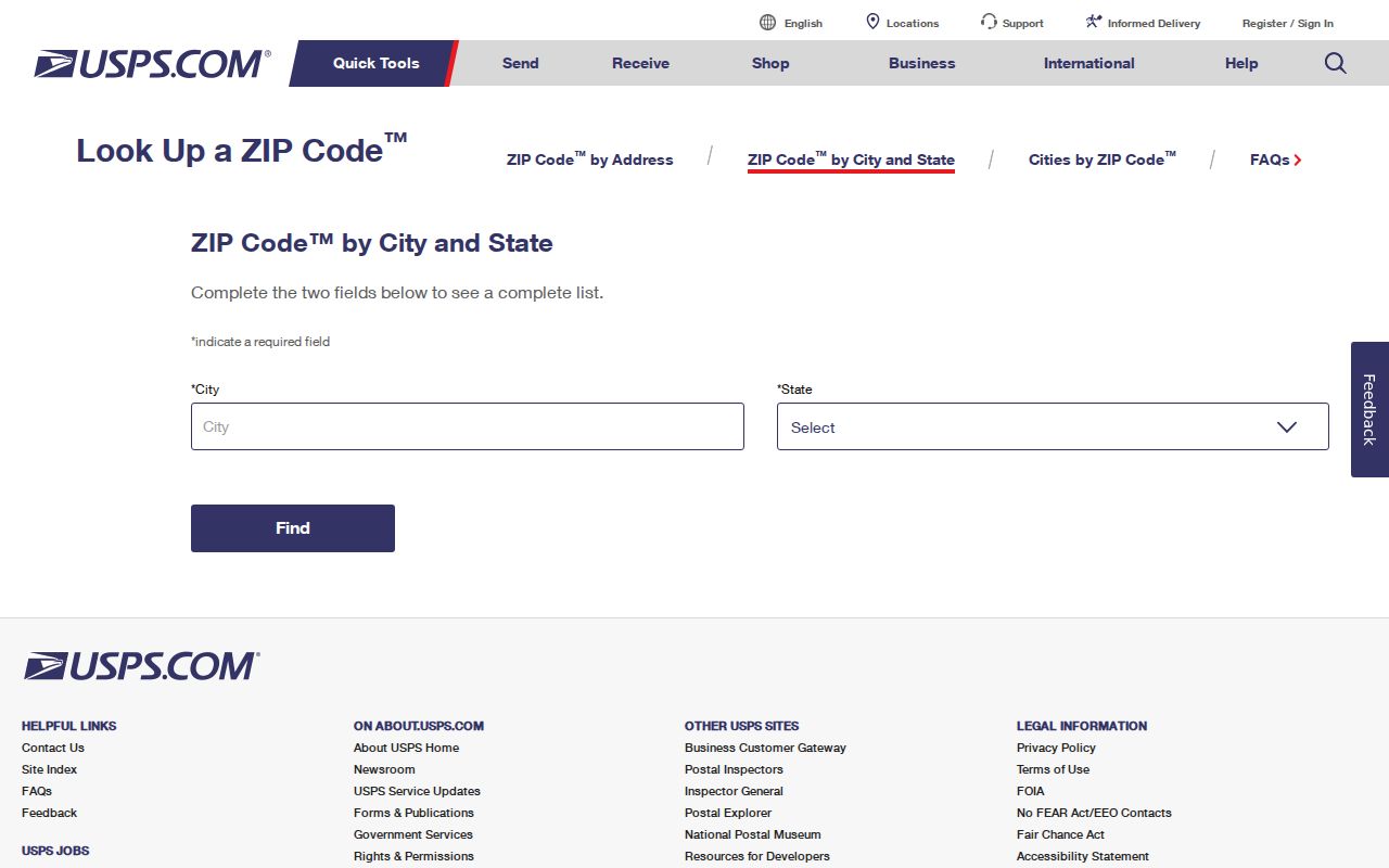
City and state results are useful for postal orientation, but a full street address is still needed for a parcel and jurisdiction match.
USPS and ZCTA Difference
USPS postal codes and Census postal-code tabulation areas are not the same thing. ZCTAs approximate groups of mailing ZIPs for demographic work. They generally omit PO-box-only and unique institutional codes. A per-ZIP population figure therefore means a Census approximation, not a USPS count and not the population of a named city.
The Census ZCTA guidance image explains the statistical geography used beside postal data.
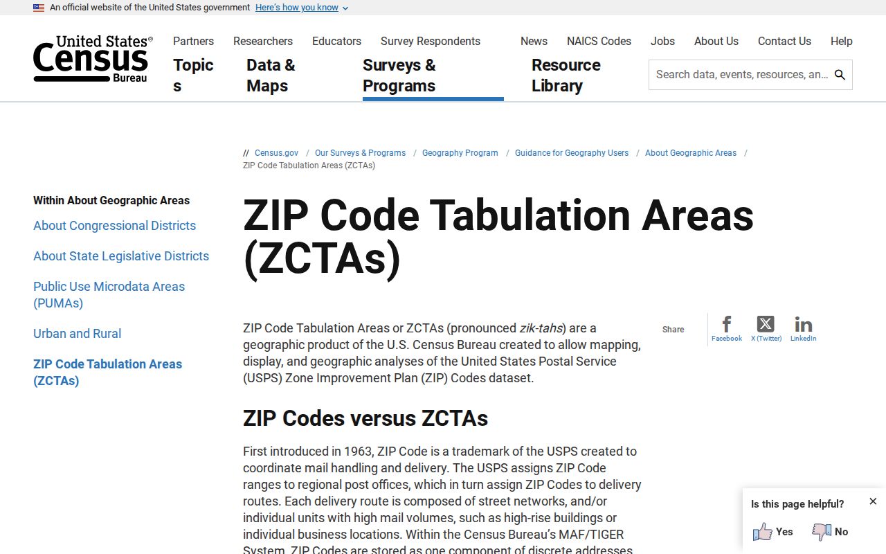
For a record search, use the five-digit ZIP only as a locality clue. A named person still needs an address, parcel, event, or historical source that can be checked.
From ZIP to Santa Cruz APN
Planning and address jurisdiction closes the gap between postal geography and public records. The county planning route applies to unincorporated parcels, while incorporated cities keep their own permit systems. The Santa Cruz County Planning capture shows the county-side address and planning context.
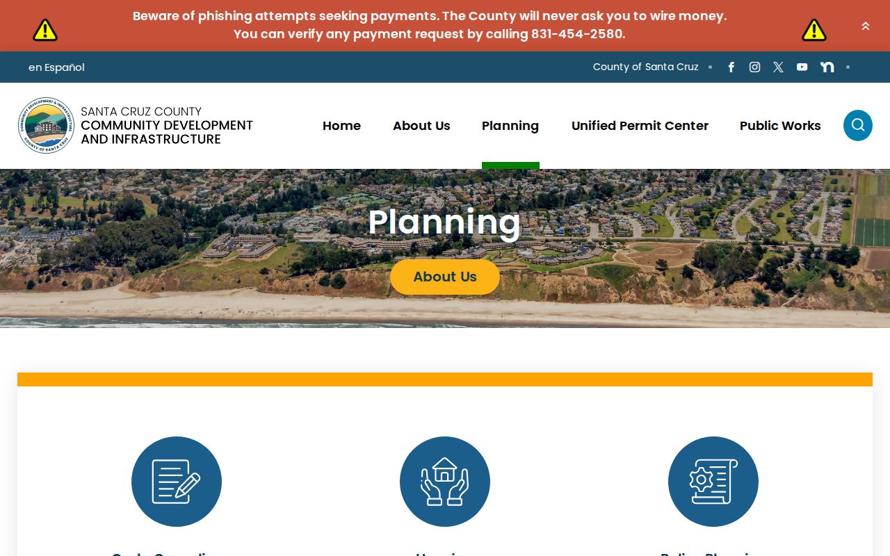
Once the APN and jurisdiction are known, the ZIP has served its routing purpose. The address can move into a street directory, a parcel search, a deed chain, a permit file, or a historical directory year. For a full street-level chain, use the Santa Cruz County street directory workflow.
ZIP labels can shift, postal communities can overlap, and old maps can use different names. Preserve the old term alongside the current APN and legal description. That small habit keeps the Santa Cruz County postal index tied to the record trail it is meant to begin.